3,712 fire hotspots ring Lahore in a week as the city tops the world’s pollution ranking again
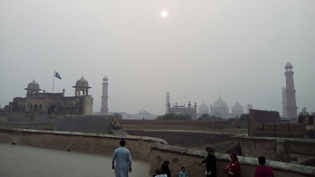
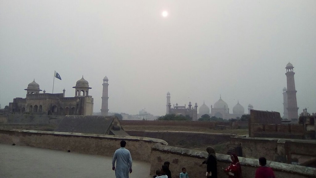
File photo: Badshahi Mosque seen through haze from Lahore Fort (Wikimedia Commons, CC BY-SA 4.0). The photo shows Lahore in hazy conditions; it is not today's AQI reading.
Lahore’s smog is not letting go, and satellite data has now put a number on one of its biggest drivers. The Pakistan Air Quality Initiative’s latest analysis found 3,712 fire hotspots within a 300-kilometre radius of Lahore in a single week — 2,753 of them in Pakistan and 957 in India. On Thursday the city’s Air Quality Index stood at 360, and Lahore was once again ranked the world’s most polluted city.
Where the fires were
The figures cover 27 October to 2 November, drawn from NASA’s Fire Information for Resource Management System. Pakistan’s weekly count was 15 per cent higher than the 2,390 recorded in the same period last year, and 51 per cent above the eight-year average of 1,824 for those dates. India, by contrast, recorded only 957 hotspots, far below its eight-year average of 10,448. The combined figure for both countries this year was 3,712 — against 21,157 in 2020 and 19,674 in 2018. The analysis also found that as the fires multiplied in the second half of October, Lahore’s daily average PM2.5 climbed from around 220 to 285 micrograms per cubic metre near 1–2 November.
Thursday on the ground
Across the city on Thursday, readings pushed into the hazardous band. Multan Road and Safari Park crossed 500, Kahna recorded 498, DHA Phase-6 428, Barki 407, Shahdara 359, GT Road 311, Egerton Road 297, Punjab University 281, Gulberg 255 and Wahga Border 209. The Met Office put Thursday’s maximum at 31 degrees Celsius and the minimum at 17, with no chance of rain in the city in the next 24 hours, a breeze of just 3 kilometres per hour and humidity at 80 per cent. Monday 2 November had been worse — the index crossed 530 that morning — but today’s 360 still leaves Lahore at the top of the world ranking.
Not just crop burning
The experts behind the numbers are careful about what they do and do not prove. A satellite-detected hotspot is not automatically crop-residue burning: it shows heat or fire, not the activity behind it or how much smoke it produced. Each detection covers roughly 375 metres, and cloud cover can hide fires from the satellites altogether. To trace where Lahore’s air was coming from, researchers ran NOAA’s HYSPLIT model at 500 metres altitude over the preceding 72 hours, and the trajectories arrived from Afghanistan and India. Punjab Senior Minister Marriyum Aurangzeb has said winds from the Indian cities of Amritsar and Attari add to Lahore’s pollution, but the modelling only maps where the air may have travelled — it does not by itself establish the source of the pollutants. Data published by HamariHawa on 3 November showed 10,494 hotspots within a 250-kilometre radius of Faisalabad in the preceding seven days, 10,115 around Lahore, 9,537 around Sargodha and 8,836 around Gujranwala. The health department’s standing advice is for asthma patients and pregnant women to stay indoors where possible and to wear a mask outside. The wider picture is bleak: IQAir’s 2025 World Air Quality Report ranked Pakistan the most polluted country on earth, with average PM2.5 of 67.3 micrograms per cubic metre — nearly 14 times the World Health Organization’s annual guideline of 5.